Rudrasagar Fm
Type Locality and Naming
Type section is in the Well Rudrasagar-1. Interval of 2870-3115 m and it is 245 m thick. [Original Publication: Bhandari, L.L., Fuloria R.C. and Sastri Vol. Vol., 1973: Stratigraphy of Assam valley India, Bull A.A.P.G., vol. 57(s), pp. 642-656.]. Reference well: Well Geleki 8, 3589-4018 m interval and 429 m thick.
Synonyms: The coal-shale sequence overlying the arenaceous sediments within Barail strata was classified as Rudrasagar Formation (Bhandari et al., 1973). The strata in the similar stratigraphic position in the Schuppen Belt are classified into Baragolai Fm and Tikak Parabat Fm.
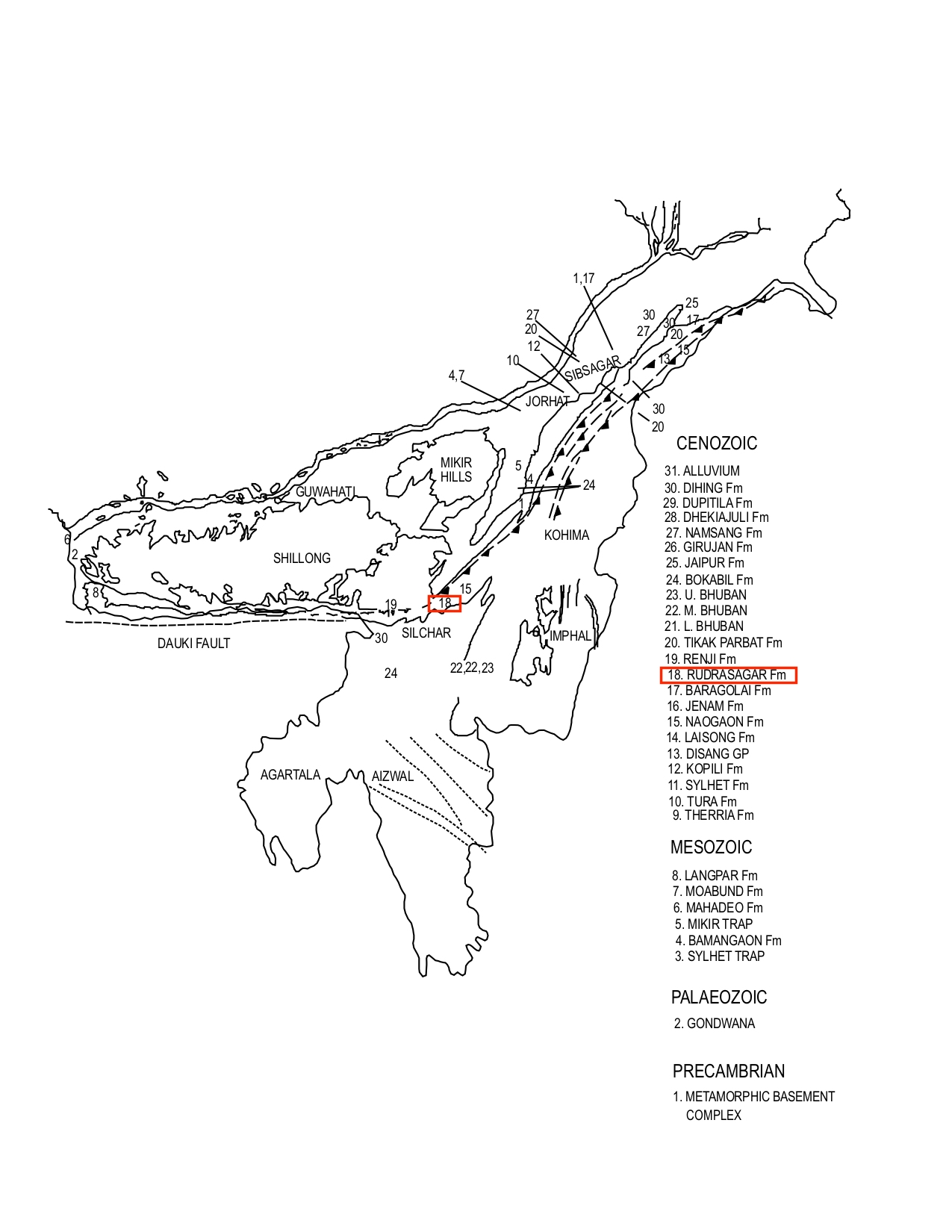
[Figure 1: Formation stratotypes of North East Basins (modified after Pandey and Dave, 1998)
Lithology and Thickness
Coal and claystone. Type section: In the type section, it is represented by a sequence essentially made up of coal and shale with non-persistent sandstones. The shales are medium grey, brownish grey, soft to moderately hard and compact, moderately to poorly fissile, often carbonaceous and contain coaly matter. The sandstones are light grey to grey, fine to very fine grained, moderately sorted, often argillaceous. The coals are black, vitreous and bituminous. The tough rare, associated limestones are light grey to brownish grey. Reference section: An interbedded sequence of coal and shale is present in the lower part. This is overlain by an interbedded sequence of sandstones, shales and coals. But again near the top the proportion of sandstone dwindles and sequence is essentially made up shales with coal. 570 m thickness is recorded in the well Charaideo-1 in the Upper Assam subsurface.
Relationships and Distribution
Lower contact
The formation has gradational contact with the underlying Demulgaon Fm (= Barail Gr; equivalent to its middle formation of Jenam F..
Upper contact
The formation has unconformable contact with the overlying undifferentiated Tipam Gr.
Regional extent
This formation is developed in the subsurface of Upper Assam and in part of Dhansiri Valley. It is also found to be present in the subthrust of Schuppen Belt. This sequence, on the whole, does not show marked variation in the constituent lithologies in the Upper Assam Subsurface. However, the proportion of shale and coal increases towards northeast especially in the Lakwa area. The proportion of coal and shale gradually decreases towards southwest with increase in the sand percentage it laterally grades into Naogaon Fm south of Mekrang.
GeoJSON
Fossils
A diverse assemblage of arenaceous foraminifera like Haplophragmoides sp., Trochammina sp., Ammodiscus sp., Cyclammina sp., Lituola sp. etc is recorded.
Age
Depositional setting
The sediments were deposited under deltaic condition.
Additional Information
